Sensing-to-Action system
EG-Way does not stop at sensing.
EG-Way completes Beyond Safety by connecting analysis and action.
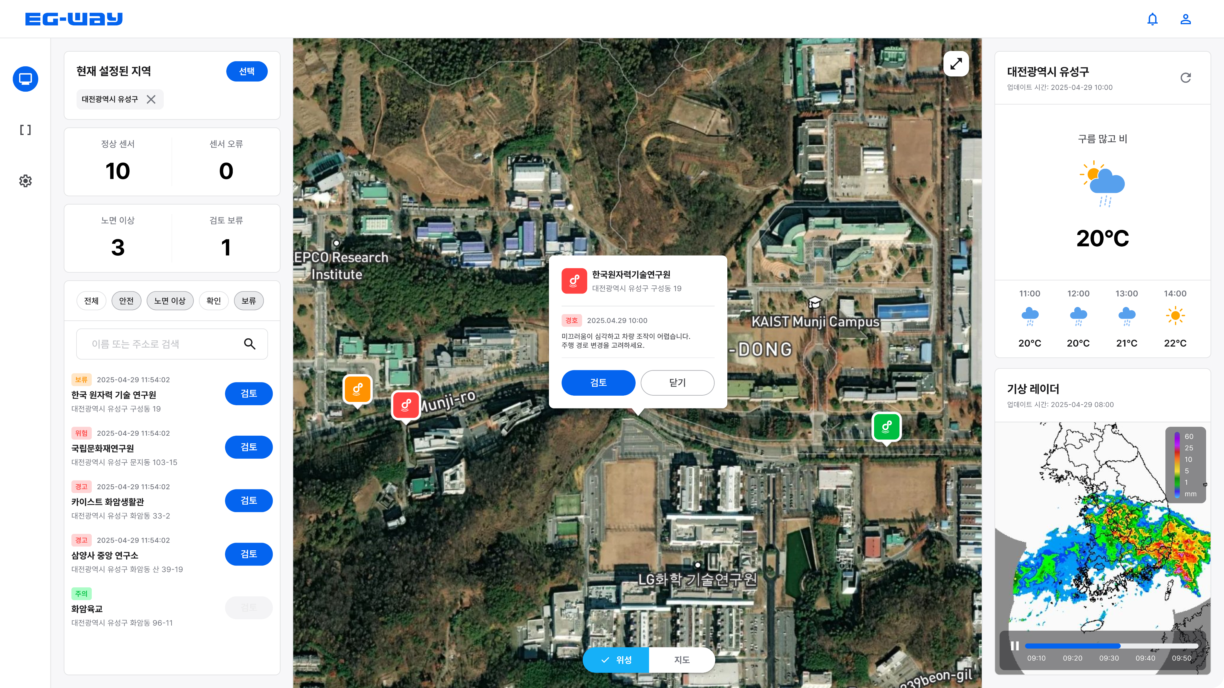
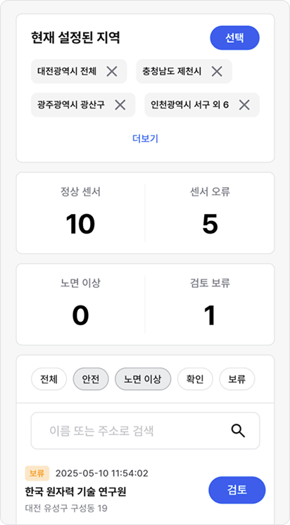
EG-Way Infra Dashboard
Share real-time road conditions on the same screen within a single dashboard.
All information, including sensor status, risk alerts, and response history, is instantly synchronized so that everyone can make the same decisions regardless of where they access it.
Real-time synchronization of sensor status, risk alerts, and response history
User-friendly and intuitive UI/UX

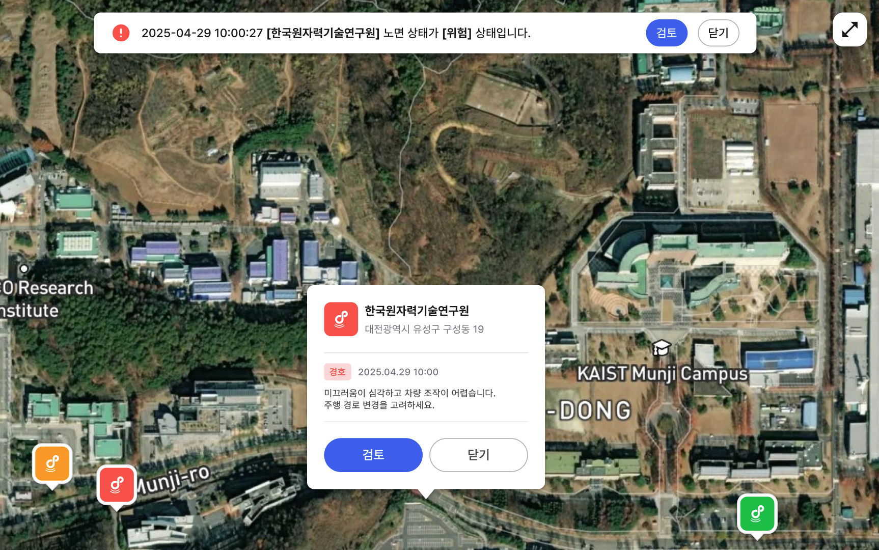
Real-time Road Map Monitoring
Even complex road networks can be easily viewed together with an intuitive map view.
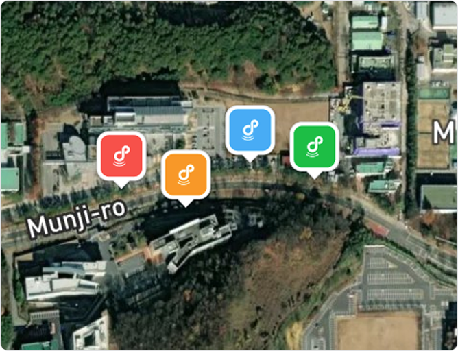
Risk areas are indicated with colored icons, allowing real-time tracking of vulnerable spots such as bridges, tunnels, and shaded areas.
When needed, you can select specific areas and discuss them with your team simultaneously.
Intuitive display of risk areas by color
Select a specific area for simultaneous monitoring
Data Analytics & History
Review past data together to analyze risk patterns.
You can even check actual images, making it immediately usable.
Data goes beyond simple records and becomes the basis for developing future response strategies.
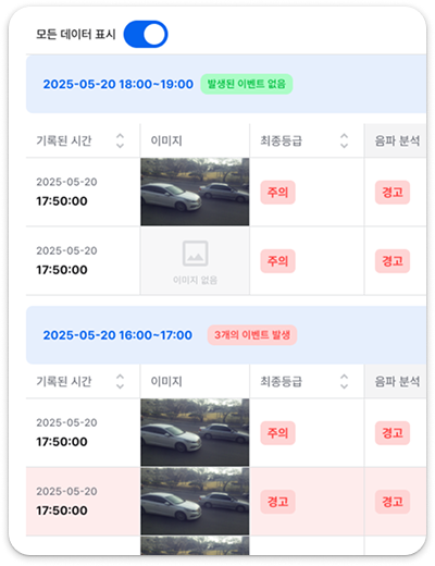
Analysis of risk patterns by time and region

View past history and check images

Establish future response strategies based on data
Road Infra Control
Sensed data leads directly to action,
automatically controlling road infrastructure.
Heating Cable
Automatically operates when signs of freezing are detected,
preventing winter accidents in advance.

VMS Display Board
Sends warnings immediately when danger occurs,
allowing drivers to recognize risks at a glance.

Saltwater Spray Device
Sprays immediately upon detecting slippery sections,
ensuring safety without manual intervention.

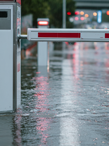
Breaker
Automatically lowers when flooding is detected,
completely blocking entry to dangerous areas.

Practical Applications
EG-Way, a platform that makes road safety smarter
The data collected by sensors does not stop at simple observation.
EG-Way analyzes this data and immediately connects it to action, expanding road safety from 'monitoring' to 'control.'
Road Department
Quickly checks for black ice or icy conditions,
automatically operates saltwater spray devices or heating cables when needed,
and supports decision-making for managers.

Smart City Department
Data collected from bridges, tunnels, and major road networks
is linked with the city control platform,
supporting disaster response policy development and smart infrastructure operation.

Transportation Department
When dangerous sections occur, VMS and variable speed signs
are immediately controlled to prevent the spread of accidents
and maintain smooth traffic flow.

Special Agencies
At key national infrastructure such as airport runways or logistics transport routes,
road surface hazards are detected in real time,
ensuring a safe environment without operational interruptions.
EG-Way Infra API
Connect road data to safety, anywhere.
The EG-Way Infra API provides road data collected through sensors and AI analysis in the form of an API.
Partners can directly integrate and use the data in their own systems and platforms without accessing a separate dashboard.